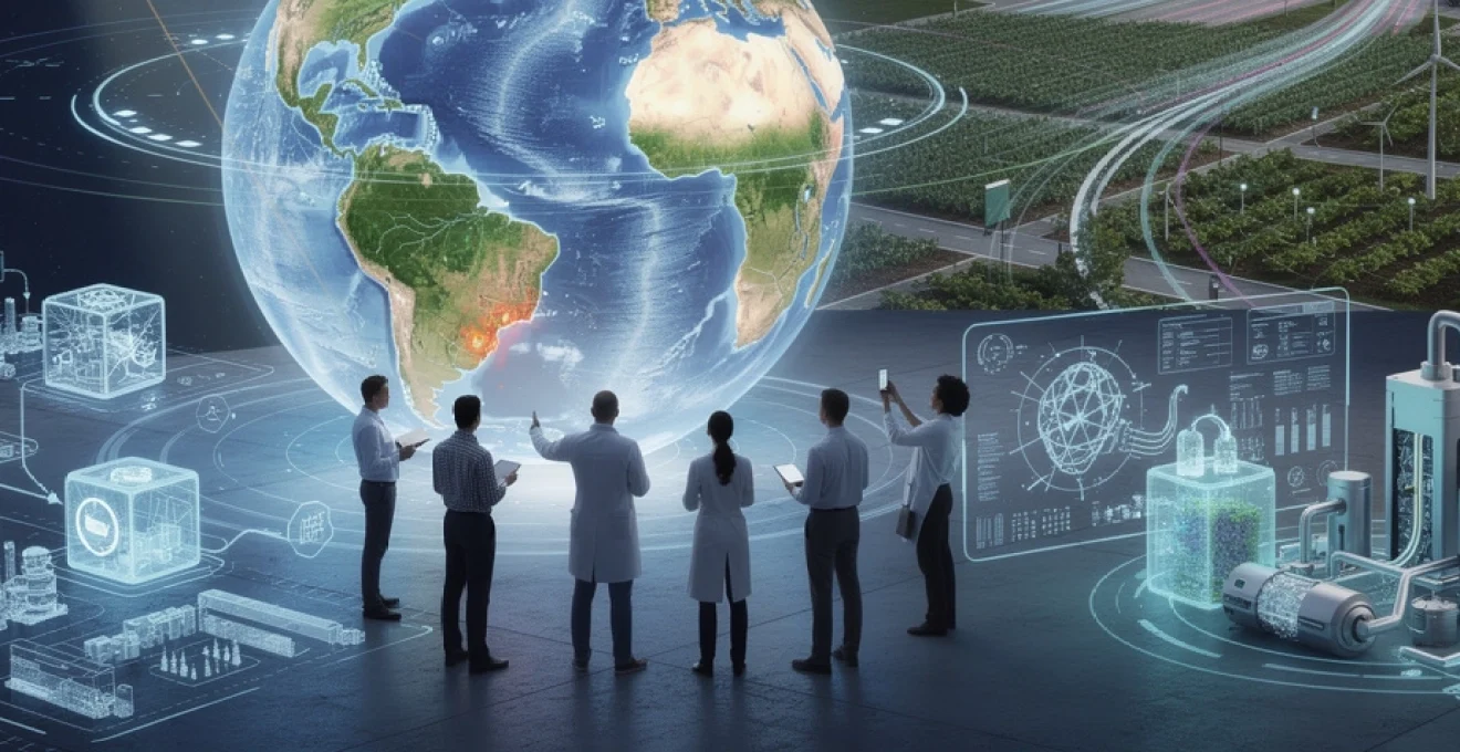
The accelerating pace of climate change demands innovative solutions that harness cutting-edge technology to monitor, predict, and mitigate environmental impacts. From melting glaciers to devastating wildfires, the challenges facing our planet require sophisticated tools that can process vast amounts of data, identify patterns, and enable swift, informed decision-making. Today’s technological landscape offers unprecedented capabilities for addressing these critical issues through satellite systems, artificial intelligence, distributed networks, and advanced materials science. These innovations aren’t merely theoretical concepts—they’re actively reshaping how governments, industries, and communities approach resource management and environmental stewardship in an era where every fraction of a degree matters.
Satellite remote sensing and earth observation systems for climate monitoring
Satellite technology has revolutionised our capacity to monitor planetary changes with remarkable precision and temporal consistency. Earth observation systems now provide continuous, comprehensive data streams that would have been impossible to collect through ground-based methods alone. These platforms enable scientists and policymakers to track environmental transformations across vast geographical areas, detecting subtle changes that might otherwise go unnoticed until they reach critical thresholds. The combination of different sensor types, orbital configurations, and data processing capabilities has created a robust infrastructure for understanding climate dynamics at multiple scales.
Synthetic aperture radar (SAR) applications in deforestation tracking
Synthetic Aperture Radar technology offers unique advantages for monitoring forest cover, particularly in regions where persistent cloud cover hampers optical imaging systems. Unlike passive sensors that rely on reflected sunlight, SAR actively transmits microwave pulses that penetrate cloud layers and vegetation canopies, providing detailed structural information regardless of weather conditions. This capability proves invaluable in tropical rainforest regions, where cloud coverage often exceeds 70% during certain seasons. The radar backscatter signatures reveal distinctive patterns when forest structures are disturbed, allowing automated algorithms to detect illegal logging activities sometimes within 24 hours of occurrence.
Recent implementations of SAR technology have demonstrated remarkable success rates in deforestation detection. The European Space Agency’s Sentinel-1 constellation, operating in C-band frequency, delivers data with a repeat cycle of just six days. When combined with machine learning classification algorithms, these systems can distinguish between natural forest dynamics and human-induced clearing with accuracy rates exceeding 92%. The all-weather capability means that monitoring programmes no longer experience seasonal data gaps, providing enforcement agencies with continuous surveillance capabilities that significantly enhance forest protection efforts.
Copernicus sentinel programme data integration for carbon emission analysis
The Copernicus programme represents Europe’s most ambitious Earth observation initiative, comprising multiple satellite missions that deliver complementary datasets for comprehensive environmental monitoring. Sentinel-5P, specifically designed for atmospheric composition monitoring, measures trace gases including carbon dioxide, methane, nitrogen dioxide, and ozone with unprecedented spatial resolution. When you integrate this atmospheric data with land surface information from Sentinel-2’s multispectral imaging, the result is a powerful analytical framework for understanding carbon cycle dynamics at regional and continental scales.
Data fusion techniques enable researchers to correlate emission sources with atmospheric concentrations, creating detailed carbon budget assessments. For instance, during the 2019-2020 Australian bushfires, Copernicus systems tracked approximately 715 million tonnes of carbon dioxide released into the atmosphere. This integration of multiple data sources provides validation for greenhouse gas inventories, helping nations verify their reported emissions against satellite-derived measurements. The freely accessible nature of Copernicus data has democratised climate research, enabling universities, NGOs, and developing nations to conduct sophisticated analyses without prohibitive costs.
LIDAR technology in glacial retreat measurement and sea level predictions
Light Detection and Ranging systems mounted on aircraft and satellites deliver extraordinarily precise elevation measurements essential for tracking ice sheet dynamics. NASA’s ICESat-2 mission, launched in 2018, uses photon-counting laser technology to measure ice surface heights with centimetre-level accuracy. The satellite fires 10,000 laser pulses per second, creating detailed three-dimensional maps of polar ice sheets and mountain glaciers. These measurements reveal not just surface elevation changes but also information about ice flow velocities, calving rates, and basal melting processes that contribute to sea level rise.
The temporal resolution of LIDAR surveys has transformed glaciology from a discipline reliant on infrequent field campaigns to one with near-continuous monitoring capabilities. Green
land Ice Sheet observations, for example, have shown an average ice loss of over 250 billion tonnes per year between 2005 and 2019. By feeding these high-resolution elevation change datasets into sea level projection models, scientists can refine estimates of future coastal flooding risk, helping urban planners and policymakers design more resilient infrastructure. In this way, LIDAR-based climate monitoring functions as an early warning system, reducing uncertainty and enabling more targeted adaptation investments.
Nasa’s MODIS and VIIRS instruments for real-time wildfire detection
While LIDAR maps vertical changes in ice, optical and thermal sensors such as MODIS and VIIRS track rapid horizontal spread of wildfires across continents. Mounted on the Terra, Aqua, Suomi NPP, and NOAA-20 satellites, these instruments capture imagery several times per day, detecting thermal anomalies as small as a few hundred square metres. Their active fire products, available in near real time, provide critical situational awareness to firefighting agencies, environmental regulators, and disaster management teams. When every hour can mean the difference between a contained blaze and a regional catastrophe, this type of satellite-based climate monitoring becomes indispensable.
MODIS and VIIRS data underpin systems like the Global Fire Information Management System (GFIMS) and NASA’s FIRMS platform, which deliver alerts within three hours of satellite overpass. These alerts help authorities prioritise limited firefighting resources, protect power infrastructure, and issue evacuation orders more effectively. Over longer timescales, archived fire records support research into changing wildfire regimes, carbon emissions from biomass burning, and the feedback loops between drought, heatwaves, and fire risk. By integrating satellite wildfire detection with ground-based sensors and meteorological forecasts, we create a multi-layered defence against one of the fastest-growing climate threats.
Artificial intelligence and machine learning models in climate prediction
As Earth observation systems generate petabytes of data, artificial intelligence provides the analytical muscle required to make sense of it all. Traditional physical climate models remain essential, but AI and machine learning can uncover hidden patterns, accelerate simulations, and enhance forecasts of complex phenomena. From recognising evolving storm structures to optimising renewable energy grids, these models bridge the gap between raw climate data and actionable insights. The result is a more responsive, adaptive approach to climate risk management that can scale with the growing volume of environmental information.
Deep neural networks for weather pattern recognition and extreme event forecasting
Deep neural networks excel at recognising subtle spatial and temporal patterns within massive datasets, making them well-suited for weather prediction and extreme event forecasting. Convolutional neural networks (CNNs), originally developed for image recognition, can ingest satellite imagery, radar outputs, and reanalysis products to identify evolving storm systems, atmospheric rivers, or heat domes that may not yet be obvious in traditional forecast fields. Recurrent neural networks (RNNs) and transformers handle time-series data, tracking how these patterns evolve over hours or days. Together, these models can flag emerging risks earlier, giving communities more time to prepare.
Consider extreme rainfall events: AI models trained on decades of historical weather data and climate indices can estimate the likelihood of flash floods in specific catchments up to several days ahead. Research projects such as DeepMind and the UK Met Office’s precipitation nowcasting system have shown that machine learning can outperform conventional methods in short-term rain forecasts at high spatial resolution. While these tools do not replace physics-based numerical weather prediction, they serve as powerful complements, refining outputs and highlighting anomalies. For local authorities and emergency services, this combination translates into more accurate warnings and potentially fewer lives lost.
Tensorflow and PyTorch frameworks in climate data processing workflows
Behind the scenes, frameworks like TensorFlow and PyTorch have become the backbone of many climate AI workflows. These open-source libraries simplify the construction, training, and deployment of deep learning models on heterogeneous hardware, from GPUs in research clusters to cloud-based accelerators. Climate scientists can prototype new architectures for tasks such as super-resolution of climate model outputs, detection of sea ice leads, or classification of land cover changes using relatively concise code. By lowering the barrier to entry, these tools accelerate innovation and make advanced machine learning techniques accessible to a broader research community.
In practical terms, an analyst might use TensorFlow to build a model that converts coarse-resolution global climate projections into fine-scale temperature fields suitable for urban heat stress assessments. PyTorch, favoured for its dynamic computation graphs, is often used in experimental setups where researchers frequently tweak model structures and loss functions. Both frameworks integrate with data processing ecosystems like xarray, Dask, and cloud object storage, allowing large-scale climate datasets to be streamed efficiently during training. The result is a more agile, iterative process for developing climate prediction tools that can rapidly adapt to new data and emerging scientific questions.
Reinforcement learning algorithms for optimising renewable energy grid distribution
As renewable energy penetration increases, balancing supply and demand on modern power grids becomes more complex. Wind and solar outputs fluctuate with weather conditions, while consumption patterns shift with human behaviour, electrification of transport, and heatwave-driven cooling demand. Reinforcement learning (RL) algorithms offer a promising approach to this challenge by learning optimal control strategies through trial and error within simulated grid environments. Much like a chess engine exploring countless moves, an RL agent evaluates different dispatch decisions, storage allocations, and demand response actions to maximise reliability and minimise emissions.
These algorithms can, for example, learn when to charge or discharge battery storage systems to smooth out solar generation spikes or to absorb excess wind energy during off-peak hours. Grid operators can also use RL models to coordinate distributed energy resources such as rooftop solar, electric vehicles, and smart appliances, turning them into a flexible “virtual power plant.” While deploying RL in real-world grids requires robust safety constraints and regulatory oversight, pilot projects have shown that AI-optimised dispatch can reduce curtailment of renewables and lower operating costs. For countries racing to integrate high shares of renewable energy, this kind of intelligent grid management may prove indispensable.
Natural language processing in climate research literature meta-analysis
The volume of climate research publications now grows so quickly that no individual expert can reasonably keep up. Natural language processing (NLP) tackles this information overload by automatically scanning, categorising, and summarising thousands of scientific papers, reports, and policy documents. Using techniques such as topic modelling, named entity recognition, and transformer-based language models, NLP systems can map emerging themes, track consensus on climate sensitivity, or highlight where uncertainties remain large. In effect, they act like a research assistant with near-infinite reading capacity.
For policymakers and NGOs, NLP-driven meta-analyses can rapidly extract key findings from Intergovernmental Panel on Climate Change (IPCC) reports or national adaptation plans, turning dense technical language into more digestible summaries. Researchers can query large corpora to identify how often certain climate risks, such as compound heat and drought events, are discussed and in what contexts. By revealing gaps in the literature—say, a lack of studies focused on specific vulnerable regions—NLP helps direct funding and attention where they are most needed. When you think about climate knowledge as a constantly evolving “data lake” of text, NLP becomes an essential tool for navigating it.
Internet of things (IoT) sensor networks for precision agriculture and water management
While satellites and AI operate at global and regional scales, the Internet of Things brings climate intelligence down to the level of individual fields, greenhouses, and watersheds. IoT sensor networks collect real-time measurements of soil moisture, temperature, humidity, and water quality, enabling fine-grained management of scarce resources. By combining these data streams with predictive analytics, farmers and water managers can shift from reactive responses to proactive strategies. The result is improved crop yields, reduced water waste, and more resilient agricultural systems in the face of climate variability.
Lorawan and NB-IoT protocol implementation in soil moisture monitoring systems
Low-power wide-area network (LPWAN) technologies such as LoRaWAN and NB-IoT play a central role in connecting remote agricultural sensors to central platforms. Designed for long-range communication with minimal energy consumption, these protocols allow battery-powered soil moisture probes to transmit data for years without maintenance. LoRaWAN, using unlicensed spectrum, is particularly popular in rural areas where cellular coverage is patchy, while NB-IoT leverages existing mobile networks for more integrated solutions. Together, they provide the “nervous system” for climate-smart agriculture across large, dispersed farms.
By installing soil moisture sensors at different depths and locations, farmers can see precisely when and where water is needed rather than relying on fixed irrigation schedules or visual inspection. This data-driven approach can reduce water use by 20–40% while maintaining or even improving yields, a critical outcome in drought-prone regions. You might think of these networks as weather stations for the soil, continuously reporting conditions that were previously invisible. When integrated into decision support dashboards or mobile apps, LoRaWAN and NB-IoT systems turn complex sensor readings into simple, actionable guidance.
Smart irrigation controllers with evapotranspiration-based scheduling algorithms
Smart irrigation controllers take sensor data a step further by automating water delivery using algorithms based on evapotranspiration (ET)—the combined loss of water through evaporation from soil and transpiration from plants. By factoring in local weather forecasts, solar radiation, wind speed, and crop type, ET-based systems estimate how much water crops actually need at any given moment. Instead of running irrigation on a fixed timetable, the controller dynamically adjusts run times and frequencies, ensuring that fields receive neither too much nor too little water.
These climate-aware irrigation systems can be particularly transformative in water-stressed regions, where every litre counts. Studies have shown that ET-based smart controllers can save up to 50% of outdoor water use in some settings, especially when replacing outdated, timer-based setups. For growers, this not only conserves a vulnerable resource but also cuts energy costs associated with pumping. When scaled up across entire irrigation districts, smart scheduling reduces pressure on rivers and aquifers, helping maintain environmental flows and ecosystem health even during prolonged drought.
Wireless sensor arrays for real-time nutrient runoff detection in watersheds
Beyond water quantity, water quality is a growing concern as climate change interacts with agricultural intensification. Heavy downpours can wash excess fertilisers and pesticides into rivers and lakes, triggering algal blooms and dead zones. Wireless sensor arrays deployed along drainage channels and watershed outlets monitor parameters such as nitrate concentration, turbidity, dissolved oxygen, and conductivity in real time. By flagging spikes in nutrient levels, these arrays act like an early warning system for pollution events.
How does this improve resource management? When you know exactly when and where runoff peaks occur, you can adjust fertiliser application, alter tillage practices, or install vegetative buffer strips to intercept pollutants. Over time, data from sensor networks can reveal which fields or practices are most problematic, guiding targeted interventions rather than blanket regulations. This kind of precision watershed management helps reconcile food production with water quality protection, aligning agricultural productivity with broader climate adaptation goals.
Edge computing devices in autonomous crop health assessment platforms
As the number of farm-based sensors, drones, and cameras grows, transmitting all raw data to the cloud for processing becomes inefficient and sometimes impractical. Edge computing addresses this challenge by performing analytics directly on local devices—be it a gateway in the field, a drone controller, or a solar-powered micro-server. In autonomous crop health assessment platforms, for example, edge devices run computer vision models that detect stress signatures, pest infestations, or nutrient deficiencies from multispectral imagery. Only processed alerts or compressed summaries are sent upstream, saving bandwidth and reducing latency.
This local intelligence means farmers can receive immediate notifications when a disease hotspot appears, long before it spreads across a field. In regions with unreliable connectivity, edge computing ensures that decision support tools remain functional even when offline, synchronising with the cloud only when a connection is available. Think of edge nodes as on-site climate and agronomy advisors, embedded directly into the landscape. By closing the loop between sensing, analysis, and action, they make climate-resilient agriculture more accessible to operations of all sizes.
Blockchain technology and distributed ledger systems for carbon credit trading
As organisations seek to reduce and offset their greenhouse gas emissions, transparent and trustworthy carbon markets become essential. Yet traditional offset schemes have been plagued by concerns about double counting, over-crediting, and opaque intermediaries. Blockchain and distributed ledger technologies offer a potential remedy by creating tamper-evident records of carbon credit issuance, transfer, and retirement. By encoding climate-related transactions in shared, verifiable ledgers, these systems aim to restore confidence in carbon markets and align financial incentives with genuine decarbonisation.
Ethereum smart contracts in transparent emissions verification protocols
Public blockchains like Ethereum enable the deployment of smart contracts—self-executing code that enforces predefined rules without the need for central intermediaries. In the context of emissions verification, smart contracts can automatically issue carbon credits when specific conditions are met, such as the verified capture of a tonne of CO2 by a direct air capture facility or the generation of a megawatt-hour of renewable electricity. Linked to trusted data sources or oracles, these contracts reduce the risk of manual manipulation and improve traceability throughout the carbon credit lifecycle.
For example, a wind farm might connect its certified energy meter to an oracle that reports generation data to an Ethereum-based contract. Each unit of clean energy produced triggers issuance of a corresponding carbon token, which can then be traded or retired. Every step—from issuance to transfer to retirement—is visible on the public ledger, allowing auditors, regulators, and even the general public to verify claims. While transaction costs and energy consumption of some blockchains remain concerns, the broader concept of programmable, transparent carbon accounting is likely to persist and evolve.
Hyperledger fabric architecture for supply chain carbon footprint tracking
Private and permissioned blockchains, such as those built on Hyperledger Fabric, are particularly well-suited for enterprise applications involving sensitive supply chain data. In these systems, companies retain control over who can access specific records while still benefiting from shared, synchronised ledgers. For carbon footprint tracking, each stage of a product’s journey—from raw material extraction to manufacturing, transport, and retail—can log emissions-related data onto the ledger. The result is an auditable, end-to-end carbon trail that accompanies physical goods through the economy.
Imagine a garment manufacturer that wants to substantiate claims about “low-carbon fashion.” Using a Hyperledger Fabric-based platform, cotton growers, spinning mills, dye houses, logistics firms, and retailers could each record their emissions and energy use. Smart contracts aggregate these inputs into a product-level carbon score, which brands can share with consumers via QR codes or digital product passports. By shining a light on upstream emissions, distributed ledgers encourage suppliers to adopt cleaner processes and allow buyers to preferentially source from lower-carbon partners.
Tokenisation models for incentivising corporate decarbonisation initiatives
Tokenisation extends beyond simple carbon credits to encompass broader incentives for climate-friendly behaviour. Companies can issue digital tokens that represent verified emissions reductions, renewable energy certificates, or even future commitments to decarbonise. These tokens can be traded, staked, or redeemed for financial or reputational benefits, creating a quasi-gamified ecosystem around sustainability performance. When designed carefully, token models align corporate interests with long-term climate goals rather than short-term cost-cutting.
For instance, a consortium of companies might establish a token that rewards investments in energy efficiency upgrades, circular economy projects, or nature-based solutions. Tokens could be allocated based on independently verified impact metrics, then used to gain preferential access to green financing, supply contracts, or carbon-neutral branding initiatives. Of course, robust governance is essential to prevent “greenwashing on-chain,” but the programmable nature of tokens allows for built-in safeguards such as automatic clawbacks if performance targets are not met. In this way, blockchain technology becomes not just an accounting tool but an engine for climate innovation.
Digital twin technology and computational modelling for urban resource optimisation
Cities sit at the front lines of climate change, concentrating both vulnerabilities and opportunities for mitigation. Digital twin technology—virtual replicas of physical systems continuously updated with real-world data—offers a powerful means of optimising urban energy use, mobility, and infrastructure planning. By simulating how buildings, roads, and people interact under different conditions, digital twins help city planners test scenarios before committing resources in the real world. This approach reduces costly trial-and-error, speeds up deployment of green infrastructure, and enhances resilience to extreme weather.
Building information modelling (BIM) integration with energy simulation software
Building Information Modelling provides a detailed digital representation of a structure’s physical and functional characteristics, from geometry to materials to mechanical systems. When you integrate BIM with energy simulation software, you gain a dynamic platform for evaluating energy efficiency measures, renewable energy integration, and indoor comfort under various climate scenarios. Architects and engineers can test different insulation levels, glazing types, HVAC strategies, and shading designs, quantifying their impact on energy demand and emissions before construction begins.
This BIM-driven approach is particularly important for retrofits, where understanding existing conditions is critical to selecting cost-effective interventions. By calibrating models with measured energy use data, practitioners can create accurate digital twins of existing buildings and explore “what-if” scenarios—for example, how a heatwave would affect cooling loads or how rooftop solar would offset peak demand. Over time, portfolios of BIM-integrated energy models give municipalities a powerful toolkit for planning building code updates, incentive programmes, and district-scale energy systems aligned with climate targets.
Agent-based modelling for traffic flow optimisation and emissions reduction
Urban transport systems involve countless individual decisions—when to travel, which route to take, what mode to use—that collectively determine congestion and emissions. Agent-based modelling (ABM) captures this complexity by simulating the behaviours of individual “agents,” such as drivers, pedestrians, or delivery vehicles, and observing how their interactions produce emergent traffic patterns. By altering parameters like public transit frequency, road pricing, or bike lane availability, planners can see how agents respond and what impact those responses have on congestion, air quality, and greenhouse gas emissions.
For example, an ABM of a metropolitan area might reveal that introducing dedicated bus lanes on key corridors not only speeds up transit but also induces a modal shift away from private cars, reducing peak-hour emissions. It can also uncover unintended consequences, such as traffic being diverted into residential streets if certain roads are restricted. This kind of simulation-based insight helps cities design policies that balance mobility, equity, and climate objectives rather than optimising one at the expense of others. In a sense, ABM turns the city into a virtual laboratory for low-carbon transport planning.
Computational fluid dynamics in urban heat island mitigation design
The urban heat island effect—where built-up areas are significantly warmer than their rural surroundings—poses serious health risks as heatwaves become more frequent and intense. Computational fluid dynamics (CFD) provides a granular view of how air and heat move through cityscapes, taking into account building geometry, surface materials, vegetation, and prevailing winds. By modelling wind flow and temperature distributions at street level, CFD helps identify hotspots, stagnant air pockets, and opportunities for natural ventilation. Planners can then test interventions such as tree planting, reflective roofing, or redesigned street canyons.
Consider a dense city block where summer nighttime temperatures remain dangerously high. A CFD analysis might show that adding green roofs and strategically placed shade trees could lower surface temperatures by several degrees while improving pedestrian comfort. It may also reveal that certain building orientations trap hot air, suggesting the need for design guidelines in future developments. While these simulations are computationally intensive, they offer a level of detail that broad-scale climate models cannot match, enabling microclimate-sensitive urban design that directly addresses local heat stress.
Gis-based spatial analysis tools for sustainable infrastructure planning
Geographic Information Systems (GIS) underpin many aspects of climate-aware urban planning by integrating spatial data layers—from flood risk maps and land use classifications to transport networks and socio-economic indicators. By overlaying these datasets, planners can identify where climate hazards intersect with vulnerable populations and critical infrastructure. This spatial perspective supports prioritisation of adaptation measures, such as elevating substations in flood-prone zones or adding cooling centres in neighbourhoods with limited green space and high heat exposure.
GIS tools also facilitate scenario analysis for low-carbon infrastructure investments. For instance, they can help map optimal routes for new cycling corridors, identify rooftops most suitable for solar installations, or locate potential sites for nature-based stormwater management. When combined with digital twin platforms, GIS-based analysis allows cities to visualise proposed interventions in 3D, communicate plans clearly to stakeholders, and refine designs based on community feedback. In effect, GIS serves as the spatial “glue” that connects climate data, engineering models, and policy decisions.
Advanced materials science and nanotechnology in carbon capture systems
Beyond monitoring and modelling, addressing climate challenges ultimately requires technologies that can reduce atmospheric greenhouse gas concentrations and minimise resource consumption. Advanced materials science and nanotechnology are at the forefront of these efforts, enabling more efficient carbon capture, energy conversion, and water treatment systems. By designing materials at the molecular or nanoscale level, researchers can tailor properties such as surface area, selectivity, and conductivity to achieve breakthroughs in performance. These innovations move us closer to a future where climate mitigation technologies are not only effective but also economically viable.
Metal-organic frameworks (MOFs) for direct air capture applications
Metal-organic frameworks are crystalline materials composed of metal ions connected by organic linkers, forming highly porous structures with enormous internal surface areas. This architecture makes MOFs particularly attractive for capturing CO2 from dilute gas streams, including ambient air. By carefully selecting metal centres and organic ligands, scientists can tune MOFs to preferentially adsorb CO2 over other gases, even at low concentrations. Some MOFs boast surface areas exceeding 7,000 m2 per gram—equivalent to the area of a football field in a teaspoon of material—providing ample space for gas molecules to bind.
In direct air capture systems, MOFs can be deployed in modular contactors where air flows through packed beds of sorbent. Once saturated, the MOF is regenerated by applying heat, vacuum, or moisture, releasing concentrated CO2 for storage or utilisation. Compared with conventional sorbents, MOFs promise lower regeneration energies and greater selectivity, which are crucial for driving down the cost per tonne of CO2 removed. Challenges remain around material stability, scalability, and long-term performance, but ongoing research and pilot projects indicate that MOF-based capture could become a key component of negative emissions portfolios.
Graphene-based membranes in water desalination and purification technologies
Water scarcity is tightly interwoven with climate change, as shifting precipitation patterns and droughts strain existing supplies. Desalination and advanced purification will play a growing role in securing freshwater, but conventional processes can be energy-intensive. Graphene-based membranes offer a pathway to more efficient water treatment by exploiting the remarkable properties of a single-atom-thick carbon lattice. When engineered with nanoscale pores or functionalised channels, graphene and graphene oxide sheets can act as ultra-thin, highly selective filters that allow water molecules to pass while blocking salts, pathogens, and organic contaminants.
Because these membranes are so thin, they can achieve high flux—moving large volumes of water with lower pressure and, consequently, lower energy input. Pilot studies have demonstrated that graphene oxide membranes can remove over 99% of common salts under laboratory conditions, pointing towards their potential in next-generation reverse osmosis or forward osmosis systems. Beyond desalination, graphene-based filters can be used for point-of-use purification in remote or disaster-affected areas, providing safe drinking water with compact, portable devices. In a warming world where both floods and droughts threaten water security, such materials expand our toolkit for resilient water resource management.
Perovskite solar cells and third-generation photovoltaic efficiency improvements
Scaling up clean energy production is fundamental to any credible climate strategy, and solar photovoltaics remain a central pillar of that effort. Perovskite solar cells, named after their crystal structure, have emerged as one of the most promising third-generation photovoltaic technologies. In just over a decade, laboratory-scale perovskite cells have achieved power conversion efficiencies exceeding 25%, rivaling or surpassing traditional silicon cells while using potentially cheaper, solution-based manufacturing techniques. Their tunable bandgaps also make them well-suited for tandem configurations, where perovskites are stacked on top of silicon to capture a broader portion of the solar spectrum.
What stands between perovskites and widespread deployment? The main hurdles involve long-term stability, sensitivity to moisture and heat, and concerns about lead content in many formulations. Researchers are actively exploring encapsulation strategies, alternative compositions, and scalable fabrication methods to address these issues. If successful, perovskite-based modules could lower the cost of solar electricity further, accelerate rooftop and utility-scale deployment, and expand energy access in regions currently underserved by the grid. Combined with advances in storage and grid management, high-efficiency photovoltaics will form the backbone of a low-carbon energy system designed to meet global climate goals.