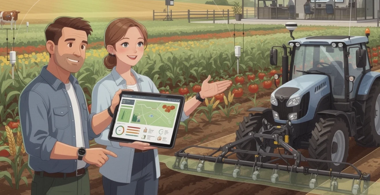
The agricultural landscape is undergoing a dramatic transformation as digital technologies revolutionise traditional farming practices. Smart agriculture represents a fundamental shift from conventional methods to data-driven, technology-enhanced farming systems that promise to address the mounting challenges of feeding a growing global population whilst maintaining environmental sustainability. This technological revolution encompasses precision agriculture, Internet of Things (IoT) sensors, artificial intelligence, and automated machinery, creating integrated farming ecosystems that optimise resource utilisation and maximise crop yields.
Modern farmers are embracing these innovations not merely as optional enhancements, but as essential tools for remaining competitive in an increasingly complex agricultural marketplace. The convergence of climate change pressures, labour shortages, and rising input costs has created an urgent need for more efficient and sustainable farming practices that smart agriculture technologies can provide.
Precision agriculture technologies revolutionising crop management systems
Precision agriculture has emerged as the cornerstone of modern farming operations, transforming how farmers manage their fields through data-driven decision making. This approach enables farmers to treat each section of their fields according to specific requirements rather than applying uniform treatments across entire areas. The technology suite supporting precision agriculture includes GPS guidance systems, variable rate application equipment, and sophisticated monitoring tools that collect and analyse field data in real-time.
The economic impact of precision agriculture adoption has been substantial, with studies indicating yield increases of 10-15% alongside input cost reductions of up to 20%. These improvements stem from the technology’s ability to eliminate waste whilst ensuring optimal growing conditions for crops. Modern precision farming systems integrate multiple data sources to create comprehensive field management strategies that respond dynamically to changing conditions throughout the growing season.
Gps-guided variable rate application systems in modern tractors
GPS-guided variable rate application (VRA) technology has revolutionised how farmers apply fertilisers, seeds, and crop protection products across their fields. These systems utilise sub-metre accuracy GPS positioning to create detailed application maps that vary inputs based on soil conditions, historical yield data, and crop requirements. Modern tractors equipped with VRA systems can automatically adjust application rates whilst maintaining optimal speed and accuracy, eliminating overlaps and gaps that traditionally resulted in wasted inputs and uneven crop development.
The integration of RTK (Real-Time Kinematic) GPS technology has elevated positioning accuracy to centimetre-level precision, enabling farmers to create permanent traffic lanes and implement controlled traffic farming systems. This precision reduces soil compaction whilst optimising field operations, with some farms reporting fuel savings of 15-20% through improved operational efficiency and reduced overlap.
Drone-based multispectral imaging for NDVI crop health assessment
Unmanned aerial vehicles equipped with multispectral cameras have become indispensable tools for crop health monitoring and assessment. These drones capture imagery across multiple electromagnetic spectrum bands, enabling the calculation of vegetation indices such as NDVI (Normalised Difference Vegetation Index) that indicate plant health, stress levels, and growth patterns. The ability to survey large areas quickly and repeatedly provides farmers with timely insights into crop conditions that would be impossible to obtain through traditional ground-based scouting methods.
Advanced drone systems can identify problem areas within fields before symptoms become visible to the naked eye, allowing for targeted interventions that prevent yield losses. The high-resolution imagery produced by these systems enables farmers to create prescription maps for variable rate applications, ensuring that inputs are applied only where needed and in appropriate quantities.
Soil sampling technologies using veris OpticMapper and ph sensors
Modern soil sampling technologies have evolved beyond traditional manual collection methods to incorporate automated systems that provide comprehensive soil analysis across entire fields. The Veris OpticMapper represents a significant advancement in soil sampling technology, utilising optical sensors to measure soil properties in real-time as equipment moves across fields. This system creates detailed soil maps that reveal variations in organic matter, pH levels, and nutrient content with unprecedented spatial resolution.
Integrated pH sensors and electrical conductivity measurements provide additional layers of soil data that inform variable rate lime and fertiliser applications. These technologies enable farmers to address soil variability precisely, optimising growing conditions for different areas within single fields whilst minimising input costs and environmental impact.
John deere operations center integration with field management software
The John Deere Operations Center exemplifies the integration of machinery data with comprehensive field management software platforms. This cloud
platform aggregates agronomic, machine, and operational data from connected equipment, allowing farmers to visualise everything from seeding rates and fuel usage to yield performance on a single dashboard. By synchronising this information with third-party field management software, growers can generate prescription maps, compare different management strategies, and document compliance for schemes such as environmental stewardship or carbon programmes.
For many farms, the real value lies in turning raw machine logs into actionable insights. Operators can benchmark fields, varieties, and input strategies across multiple seasons, quickly spotting which practices deliver the best return on investment. Automatic data transfer from tractors, sprayers, and combines also reduces the administrative burden, eliminating manual note‑taking and USB stick transfers. As more manufacturers adopt open APIs and data standards, mixed fleets can be integrated into similar digital ecosystems, further enhancing the benefits of precision agriculture technologies.
Internet of things sensor networks transforming agricultural monitoring
While precision machinery focuses on what happens during field operations, Internet of Things (IoT) sensor networks provide continuous visibility between passes. Distributed sensors, low‑power connectivity, and cloud analytics give farmers near real-time insight into soil, crop, and environmental conditions. Instead of relying solely on occasional field walks or historic weather averages, growers can monitor key parameters 24/7 and automate responses such as irrigation or ventilation.
These IoT-based smart agriculture systems are particularly powerful when multiple data streams are combined. Soil moisture, local rainfall, leaf wetness, and canopy temperature, for example, together provide a far clearer picture of plant stress than any single metric. As hardware costs continue to fall and open communication protocols mature, even smaller farms can deploy dense sensor networks that were previously the preserve of research trials.
Lorawan wireless soil moisture sensors for irrigation optimisation
LoRaWAN-based soil moisture sensors have become a cornerstone of smart irrigation optimisation, especially in broadacre and horticultural systems where cable-based solutions are impractical. These battery-powered probes measure volumetric water content and sometimes soil temperature at different depths, transmitting data over several kilometres to a central gateway. Because LoRaWAN is designed for low‑power, long‑range communication, devices can operate for years on a single battery, making them ideal for remote fields.
By visualising soil moisture trends across zones and depths, farmers can schedule irrigation based on actual plant-available water rather than fixed calendars or guesswork. This often results in water savings of 20–40%, whilst maintaining or even improving yields. In many cases, users integrate these readings with evapotranspiration models and weather forecasts to create decision rules or fully automated irrigation programmes. For water‑stressed regions, this kind of smart irrigation system can be the difference between profitable production and severe yield loss.
Weather station integration with campbell scientific dataloggers
On‑farm weather stations equipped with Campbell Scientific dataloggers provide high‑quality, site-specific environmental data that often outperforms regional forecasts. These stations typically monitor variables such as rainfall, wind speed and direction, solar radiation, temperature, and humidity. The dataloggers aggregate, quality‑check, and time‑stamp readings, then forward them to farm management platforms via cellular, Wi‑Fi, or satellite links.
When integrated into smart agriculture systems, this data supports a wide range of decisions. Growers can refine spray windows based on wind and inversion risk, calculate disease pressure using leaf wetness and humidity, or adjust ventilation in glasshouses according to temperature and solar load. Because Campbell Scientific equipment is designed for scientific research, it offers the reliability and accuracy required for regulatory reporting and long‑term climate trend analysis. For you as a farm manager, having your own “micro‑climate station” on the farm is like upgrading from a rough weather guess to a precision instrument panel.
Livestock tracking systems using RFID and bluetooth beacons
Smart agriculture does not stop at crops; livestock enterprises are increasingly adopting IoT tracking systems to monitor animal location, behaviour, and health. RFID ear tags enable quick identification during handling, recording movements through gates and raceways automatically. When combined with Bluetooth beacons or ultra‑wideband tags, farmers can track animals’ positions within paddocks or barns in near real time.
These systems help identify issues such as lameness, calving events, or reduced feed intake, often before visible symptoms appear. For example, a dairy cow spending less time at the feed bunk and more time lying down may trigger an alert for a health check. In extensive grazing systems, location tracking also reduces labour for mustering and improves biosecurity by recording animal movements. By turning each animal into a data point, you gain a clearer picture of herd performance and welfare, supporting both productivity and compliance with animal welfare standards.
Remote field monitoring through sigfox and NB‑IoT connectivity
In regions where traditional mobile coverage is patchy or unreliable, low‑bandwidth networks such as Sigfox and NB‑IoT are enabling remote field monitoring at scale. These technologies are designed to transmit small packets of data—such as sensor readings or equipment status—over long distances while consuming very little power. As a result, devices like water‑level monitors, gate sensors, and frost detectors can operate for years with minimal maintenance.
Remote monitoring is particularly valuable for large estates or multi‑site operations where daily physical checks are impractical. Instead of driving for hours to verify that a pump is running or a reservoir is full, managers receive automated notifications on their phones. This not only saves time and fuel but also allows faster responses to problems such as pipe breaks or sudden frost events. As connectivity options expand, we are moving towards a future where every critical asset in the farming system can “phone home” with status updates, much like an aircraft constantly reporting back to air traffic control.
Artificial intelligence applications in crop yield prediction and disease detection
Artificial intelligence (AI) sits at the heart of many smart agriculture solutions, transforming raw data from sensors, satellites, and machinery into predictive insights. Rather than reacting after problems occur, AI-driven tools help farmers anticipate risks, optimise input use, and forecast yields with increasing accuracy. Advances in machine learning, computer vision, and neural networks mean that algorithms can now recognise subtle patterns in plant health or weather trends that would be impossible for humans to spot at scale.
These AI applications are not intended to replace agronomists or farmers, but to augment their expertise. Think of them as highly specialised assistants that continuously analyse thousands of variables in the background, surfacing timely recommendations that you can accept, adapt, or reject based on local knowledge. The combination of human experience and algorithmic analysis is proving particularly powerful in early disease detection and yield prediction.
Machine learning algorithms for early blight detection in tomatoes
Early blight in tomatoes is a classic example of a disease where timing is everything: treat too late, and yield losses can be severe; spray too often, and costs and resistance risks escalate. Machine learning models trained on thousands of leaf images, weather patterns, and field observations can now flag likely early blight outbreaks several days before severe symptoms appear. These models typically use supervised learning techniques, where algorithms learn to distinguish between healthy and infected foliage based on labelled training datasets.
In practical terms, farmers may capture images via smartphones, fixed cameras in greenhouses, or drone flights. The AI system analyses the imagery, cross‑references it with humidity and temperature data, and outputs a risk score or specific treatment recommendation. Field trials have shown that such systems can reduce fungicide applications by 20–30% while maintaining or improving disease control. For growers under pressure to cut chemical use, AI-enabled disease prediction offers a pragmatic path towards more sustainable crop protection.
Computer vision systems identifying aphid infestations in wheat fields
Aphid infestations in cereals can escalate rapidly, transmitting viruses and reducing grain quality if not controlled early. Traditional scouting methods rely on manual counts along tramlines, which can miss hotspots and are labour‑intensive. Computer vision systems leverage high‑resolution imagery and object‑detection algorithms to identify aphids and associated damage across much larger areas. Mounted on drones, ground robots, or even boom sprayers, cameras continuously capture images that AI models scan for pests or honeydew patterns.
These systems do not simply produce pretty maps; they enable targeted interventions. Once aphid hotspots are identified, variable rate sprayers or spot‑treatment robots can apply insecticides only where needed, significantly reducing chemical usage. Some platforms even integrate natural enemy monitoring, helping you assess whether beneficial insects are likely to control populations without intervention. The end result is a more precise, environmentally friendly approach to pest management that aligns with integrated pest management (IPM) principles.
Neural network models predicting maize yield using satellite data
Yield prediction has long been part art, part science, but neural network models are shifting the balance decisively towards science. By ingesting time‑series satellite imagery, weather records, soil maps, and management data, deep learning models can forecast maize yield at field or even sub‑field level weeks before harvest. These models learn complex, non‑linear relationships between variables—for example, how combinations of heat stress, soil water availability, and canopy development influence final grain weight.
Accurate yield forecasts have multiple practical benefits. Growers can forward‑contract grain with greater confidence, plan storage and logistics, and evaluate the impact of different management strategies. Lenders and insurers are also beginning to use such models to refine risk assessments, potentially offering more tailored financial products. Of course, no forecast is perfect, and farmers should treat AI predictions as probabilistic guidance rather than guarantees. Yet, even a 5–10% improvement in accuracy over traditional methods can translate into significant financial advantages.
IBM watson decision platform integration with farm management systems
The IBM Watson Decision Platform for Agriculture illustrates how AI services can be embedded into broader farm management workflows. By connecting to data sources such as weather feeds, satellite imagery, soil sensors, and machinery logs, the platform generates field‑level insights on crop stress, planting windows, and input timing. When integrated with existing farm management systems, these insights appear as specific, actionable tasks rather than abstract analytics—for example, “apply nitrogen at 70 kg/ha in Zone 3 this week” or “delay fungicide in Field 12 due to low disease risk.”
For many users, the key advantage lies in the platform’s ability to translate complex data into simple dashboards and alerts that fit existing decision cycles. Rather than logging into multiple tools, you can view AI recommendations alongside financial records, compliance documentation, and operational plans. This tight integration reduces the friction of adopting digital tools and helps ensure that AI-driven recommendations actually influence day‑to‑day farming decisions.
Automated machinery and robotic systems in contemporary agriculture
Automated machinery and agricultural robots are rapidly moving from experimental prototypes to commercial reality. Autonomous tractors capable of operating without a driver in the cab, robotic weeders that distinguish crops from weeds with computer vision, and harvest robots for high‑value fruits are all now working on commercial farms. These systems aim to tackle chronic labour shortages, improve timeliness of operations, and increase the precision of tasks such as planting, spraying, and harvesting.
Autonomy in field operations relies on a combination of RTK‑GPS, LiDAR, cameras, and onboard computing to navigate safely and accurately. For you as a grower, the immediate benefits often appear in extended working hours and greater consistency. A robotic sprayer, for example, does not get tired at 3 a.m. and can maintain optimal boom height and speed throughout the job, reducing overlaps and misses. Over time, fleets of smaller, lighter robots may also help address soil compaction by replacing a few very heavy machines with many lighter ones.
Data analytics platforms driving evidence-based farming decisions
As smart agriculture technologies proliferate, farms are generating unprecedented volumes of data—from yield maps and sensor readings to drone imagery and livestock performance records. Data analytics platforms bring this information together, turning disconnected data streams into coherent, evidence-based insights. Cloud-based systems provide dashboards, benchmarking tools, and decision support modules that help farmers evaluate what is working, what is not, and where adjustments will deliver the greatest return.
These platforms often incorporate business metrics alongside agronomic data, allowing you to move beyond “did this field yield well?” to “did this field make money?” Growers can compare gross margins by variety, field, or management practice, quickly identifying underperforming areas. Advanced users apply scenario analysis, asking questions such as “what if I reduce nitrogen by 20% on my best soils?” or “how would a shift to strip‑till affect fuel use and labour demand?” In this sense, data analytics becomes a decision simulator for the farm business, not just a record‑keeping tool.
Sustainable resource management through digital agriculture solutions
Ultimately, the promise of smart agriculture is not only higher productivity but also more sustainable use of land, water, and inputs. Digital tools enable farmers to apply fertiliser, water, and crop protection products more precisely, reducing waste and off‑target impacts. Variable rate nutrient management based on soil and yield maps can cut fertiliser use by 10–30% while maintaining yields, lowering both costs and greenhouse gas emissions. Similarly, smart irrigation control guided by soil moisture and weather data conserves scarce water resources and protects aquifers from over‑extraction.
Digital agriculture solutions also support broader sustainability goals such as biodiversity enhancement and carbon sequestration. For example, satellite monitoring and field‑scale models can quantify the impact of cover crops or reduced tillage—both central to regenerative agricultural systems—on soil organic carbon stocks, providing evidence for emerging carbon credit schemes. Habitat mapping tools help identify where field margins, hedgerows, or flower strips will deliver the greatest ecological benefit with minimal yield penalty. As regulators, food companies, and consumers increasingly demand proof of sustainable practices, farms that can document their performance with robust data will be better positioned in the marketplace.